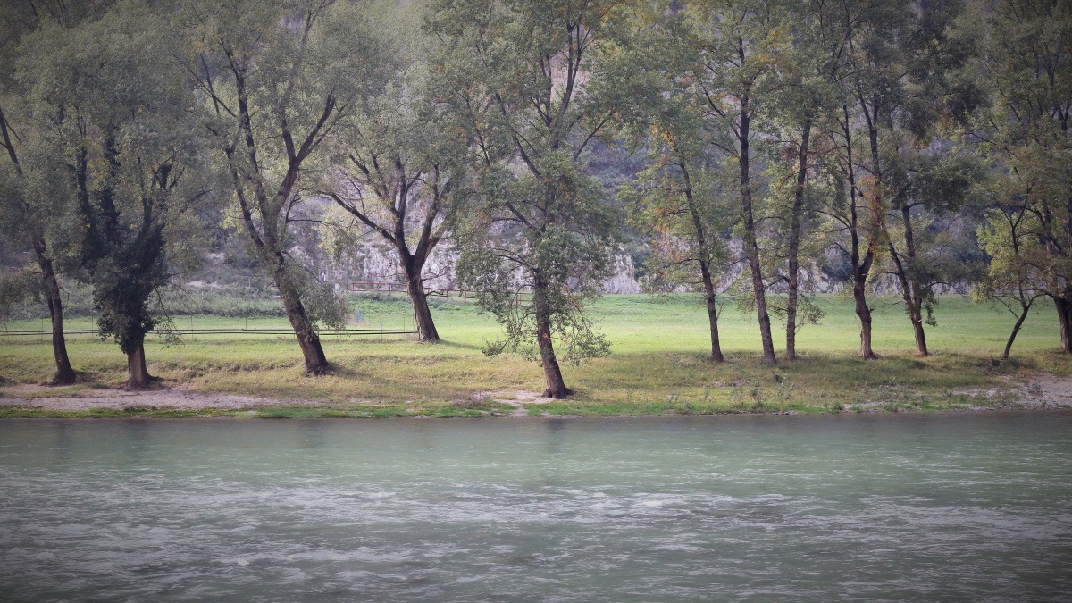
For the making of his documentary ‘Stories of Land and Water: Adige Etsch’, filmmaker Vittorio Curzel walked upstream towards the source of the Adige river. It was a journey that started at the valleys that face the Adriatic sea and culminated at the doors of Mitteleuropa. In this essay, Curzel reflects on the power of the river both in its capacity to nourish the communities populating its shores, and also as a symbolic vehicle for the construction of diverse cultural identities.
When I began to think about the film Stories of land and water: Adige/Etsch, I knew that what I would collect would be images of a heterogeneous and iridescent landscape, the result of countless events, both human and natural, that through the course of time have shaped the form of the river. I tried to relay the echo of this long story – of the continuous workings of the water and of the inhabitants of the surrounding lands – that is sometimes slow, other times violent and dramatic.
By walking on foot along the Adige river banks, and sometimes sailing its waters, I embarked upon a journey that started at the mouth of the river, situated at the edge of the Delta del Po park, between the villages of Chioggia and Rosolina, and ending at its source, close to Passo Resia at an altitude of 1550 m. It was a journey of almost 410 km, between the Adriatic Sea and the Alps, across different environments and cultures, from the Veneto plains to the valleys of Trentino-Alto Adige/Südtirol.
As the second longest river in Italy, once navigable in all its length from the sea to the edge of Bolzano, the Adige connects the Italian cultural world with the German one, the Mediterranean with central Europe. The river’s basin, which spans an area of about 12,100 km2, includes 369 municipalities, in the provinces of Bolzano, Trento, Verona, Vicenza, Belluno, Padua, Rovigo, Venice and a small portion of the Swiss Canton of Grisons. The total population of the area is around 1,320,000 inhabitants.
The highest mountain of the basin is Ortles (3902 m), located in the Stelvio National Park. In the basin, there are 185 glaciers (forming a total surface of about 128 km2) of which 155 feed directly into the river. Traversing diverse geomorphological environments, the waters that descend from the mountains of the Trentino Alto Adige/Südtirol region merge with those of the river Ram (Rom/Rambach) which runs through the Val Monastero (Val Müstair/Münstertal) in Switzerland, as well as those of other torrential waters in the province of Verona, located in the southern slopes of Monte Baldo and the Lessini mountains and, further east, between the provinces of Verona and Vicenza.
Over time, the great rivers represented a significant factor in the development of territories, often decisively conditioning the historical, political, social and economic events unfolding in their surroundings. The Adige valley, is a morphological structure of fundamental importance throughout the Alps, as it crosses the most expansive part of the mountain range.
Beyond the watershed, other river courses (Inn, Lech, Iller) spread out towards the east and the north. This hydro-graphical network, along with two easily accessible mountain passes – the Brenner Pass and the Reschen Pass – has, since ancient times, contributed to the development of a complex system of communications between the Mediterranean and Central-Northern Europe, mainly owed to a growing demand for the circulation of goods as well as particular political and institutional contexts.
River transport, although less regular and potentially more risky for merchandise, was faster and generally less expensive than land transport, particularly for heavy and large goods. Sources from the late eighteenth century describe rafts of around 12 meters in length, capable of bearing a load of 10 tons.
For a long period of time, one of the main products of the mountain region was wood. Local and foreign merchants organised the systematic exploitation of the Trentino-Tyrolean forests, and until the advent of the railway, the watercourses were the main connection with the destination markets. The water allowed for the transport of timber, that would be floated downstream to be collected by the ‘zattieri’ (log drivers) and transported to the sea. Not only was this timber for the construction of Venice and its ships, but was also required in large quantities by urban centres of the Po valley, such as Verona, Mantova and Brescia. The use of rafts on the Adige has been documented since the ninth century.
Ancient roads also ran along the Adige. Roads such as Via Claudia Augusta were travelled by pilgrims, emperors and armies, as well as by scientists and many artists, painters, musicians, poets, writers. Up until the nineteenth century, the movement of people and goods from one place to another was slow: on foot or horseback, by carts and carriages or by boat.
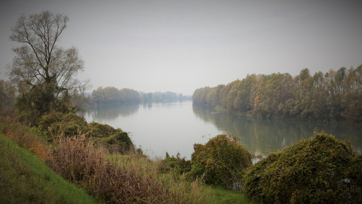
In the second half of the 1800s, the construction of the Brenner railway, completed in 1867, quickly transformed a world that had remained almost unchanged for centuries. This railway was the first to completely cross the Alps, comfortably and quickly transporting travellers and merchandise from Innsbruck to Verona. The role of the river as a means of transport and communication was lost, and soon mountain roads and paths became mule tracks for the armies of the First World War.
Overlooking the Adige lie important towns and small lakeside villages, rich in cultural, artistic and environmental heritage. For centuries, the river and its tributaries have played a central part in the daily life of the communities, providing food through fishing, pastures for the grazing of animals along its banks, agriculture in irrigated fields, raw material for the construction of houses, energy for the mills and for artisanship, and finally a transport route for goods.
The river has been an essential element of the physical and human geography of its surrounding territories, in part, due to its influence on the climate. It allows the mild Mediterranean climate to extend to Bolzano/Bozen, Merano/Meran and their surroundings, giving these areas particular climatic and meteorological characteristics. This has had clear economic consequences. For example, within a century, Alto Adige/Südtirol and Trentino became a European epicentre for the production of high-quality apples. Tourism has obviously benefited greatly from these climatic conditions as well.
Along the river, from the source to the sea, there are some of the best farmlands of northern Italy, with extensive vineyards and fertile soil for the production of fruit and vegetables. In addition to the irrigation of the countryside, the waters of the river are today also used for the production of electricity within over 220 plants, built mostly between the twenties and the sixties on the high river basin.
Devastating floods (the two largest were in September 1882 and November 1966, and in November 1951 for the Polesine area in particular), major reclamation, works of regeneration and improvement of the riverbed, have repeatedly changed the course of the river.
In the 16th century, the Republic of Venice made many significant interventions throughout the lowlands. This included creating embankments and removing meanders. The intent was not only to limit the risk of the disappearance of the lagoon under excess earth, thus ensuring inland navigation, but also to mitigate the effects of periodic flooding, thereby also protecting the soil for agricultural purposes.
Of significance is also the construction imposing walls, in the city of Verona, built between 1889 and 1894, as well as the elimination of some of the distributaries where they traversed the built environment. In the mountainous part, major works took place from the beginning of the 19th century. These included both the regulation of the river for hydroelectric purposes as well as to expand the cultivable land and to develop transport infrastructures. These numerous interventions include the diversion of the Adige course near Trento, with the removal of the river from the city, the modification of the course between Merano and Rovereto, and the construction of bridleways to retain the materials carried by the current.
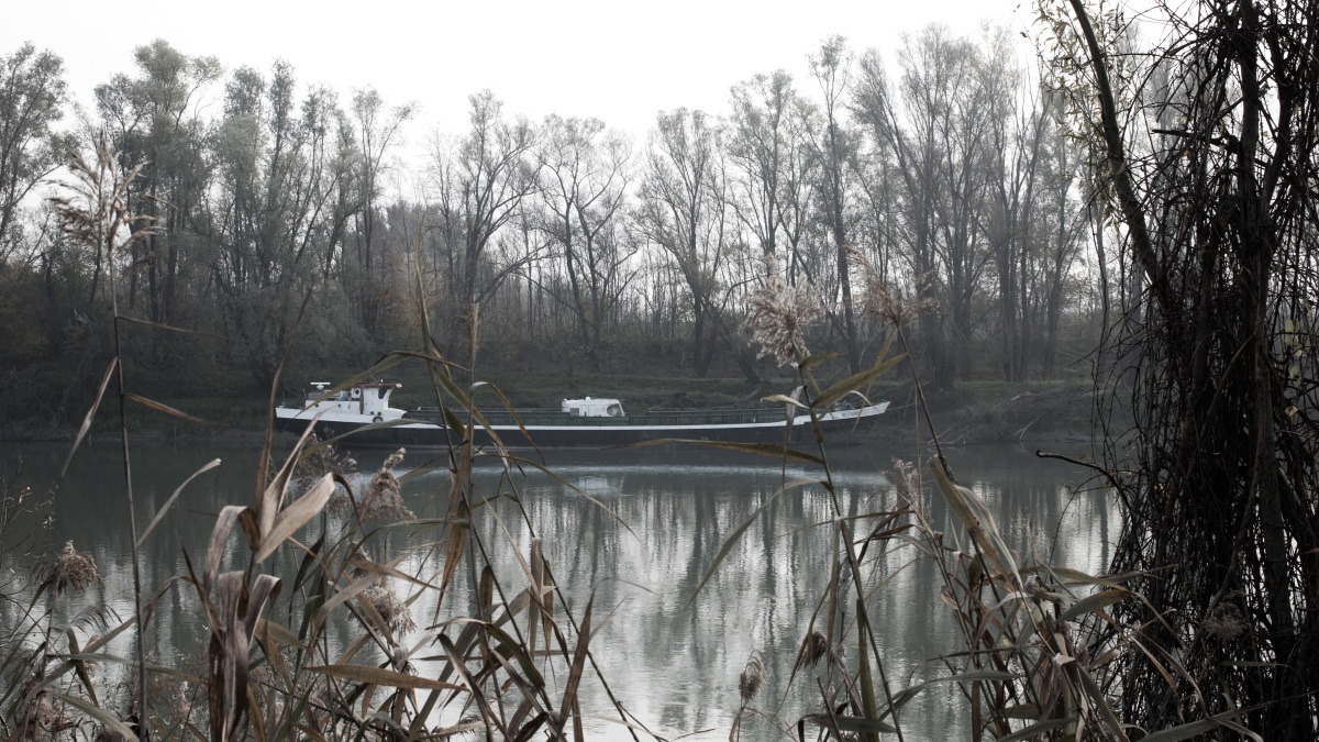
Not only have these interventions gradually redefined the path of the river (shortening its length by a few kilometres), but have also profoundly changed its surrounding landscape, its function, its role within the economy of the territories, not to mention, affected the inhabitants’ perception of the river itself. However, unlike other major European rivers, the perception of the Adige has for centuries been confined to each local community, rather than being framed within an overview that conceives the waterway as an entire stretch from the mountains to the sea.
The river’s particular geopolitical context, which included the subdivision of the territory into various seigniories and later, up until 1919, between different state authorities, also meant that the aforementioned interventions have been carried out in a fragmented way for centuries. Each community and local authority sought to exploit the resources of the river in the most effective way for themselves in order to mitigate dangers only within their territory, also due, in part, to the technical difficulties of developing a broader design. Over time, this gave rise to disputes between the territories, since interventions carried out upstream for the solution of local problems could have negative consequences and increase the downstream hydro-geological risks.
In the 19th century, a series of imposing works aimed at the regulation of the river and its surrounding territory, in particular in its alpine part, adhered to a framework inspired by technical rationality, positivism and the belief in scientific progress that characterised the ideological-cultural climate of the time. Thus, an operation of differentiation between water and land and a separation between river and territory was undertaken, ending the osmosis between the two elements that, until then, had characterised ‘the hybrid state’ of the Adige valley and its marshy landscape – a totally inadequate scenario for the functional order that the spirit of the time intended to pursue.
These works, closely tied with major infrastructural interventions on the territory, as well as the industrialisation of numerous urban areas, marked the beginning of a process of ‘nationalisation’ of the river, in which the Adige, as well as the mountains surrounding the first part of its course, became the ground for national demands and territorial claims.
In the same period, between the late 19th century and the beginning of the 20th, the Adige river’s symbolic aura became the centre of academic debate, offering fertile terrain for the expression of nationalistic stances.
On one side, there were renowned German-speaking geographers such as Albrecht Penck, who in 1895 classified the Adige as ‘a real Alpine river’, which in crossing the Verona lock would lose its strength and nature, to service the agricultural activities of the valleys. According to the Viennese professor, the indissoluble unity between river and mountain that characterises the Adige in its Germanic part defined the nature of the watercourse as a ‘German river’. The interventions of adjustment made in Tyrol were an act of land reclamation that ‘liberated’ the river from the swamplands that he believed characterised the Italian peninsula as well as Italianicity itself.
On the other side, and in the same year, Italian-speaking academics such as Olinto Marinelli, would invoke the ‘watershed theory’ to assert that the Italian nation should extend its borders beyond cultural-linguistic frontiers, up to the alpine ridge. This was the nation’s natural limit, as founded on geomorphological evidence which, according to Marinelli, demonstrated the bond that united the South Tyrolian mountains to the Italian plains. Geography was thus utilised as an apparatus of nationalistic rhetoric with its related expansionistic goals, within which the Adige itself was bound to have a pivotal role.
Aside from the nationalistic discourse that preceded the First World War, the particular geographic location of the river, as well as its symbolic status for the territories and different cultures that it traverses, is also reflected in numerous artistic representations from various periods.
Since ancient times, within the history of European culture, many rivers have been transformed into sacred natural elements and symbolic entities, becoming a strong characterising force of a territory, including its identity values. Here, one need only think of the Danube and the Rhine.
This gave space for the mythological personification of these watercourses, though anthropomorphised representations found in paintings, sculptures and literary works. Within these representations, the diverse historical contexts, world-views and values of the various territorial communities often emerge.
In Western iconography, rivers have usually taken forms of male figures: sometimes, of athletic young men (as is the case for the 2nd or 3rd century AD sculpture that can be seen in the key of the central arch of Ponte Pietra, in Verona), more often, powerful bearded adult men. These representations of river divinities, which were widespread throughout the Hellenistic age, and later in the imperial age (one need only think here of the statues of the Nile and of the Tiber, both from the 1st century AD, today held in the Vatican Museums and at the Louvre respectively). In the middle ages, the trend fell out of favour and the figures substituted with images of saints that protected from the dangers of the water (see, for instance, some representations of San Zeno, the patron of Verona). However, during the Renaissance, the mythological figures of the rivers began to reappear.
In the case of the Adige, the mythological-anthropomorphic representations of modern times are affected by the duality of the river’s ties with both German and Italian cultures. The focus of artists and commissioners is in fact sometimes directed towards the alpine range, at other times towards the plains, around the river mouth. Two representations are exemplary in this sense.
The first is an oil painting on canvas dating from the second half of the 17th century, held in the Museo Mercantile in Bolzano. The second one is a gilded wooden model of the 1729 Venetian bucentaur (the state barge of the doges of Venice), which can be admired in the Naval History Museum of Venice.
The painting held in Bolzano, of unknown author but most likely from Tyrol, is a lunette for the decoration of a door. Under the emblem of the Austrian archduchess Claudia de Medici (the bride of Leopold V) we see two male figures sitting on a rock. They represent the rivers Adige (Athesis) on the left, and the river Inn (Oenus) on the right. From the amphora held by the two figures, on which the names of the two rivers can be read, rivulets of water gush and merge into a unique, golden watery course, which in turn flows into the sea whose shores host city skylines (someone has suggested this to be Bolzano itself) and on which boats loaded with commodities sail.
At the base of the canvas, a scroll invokes divine benevolence, protection and fortune for the trades linked with the navigation of the two rivers. Two watercourses which, by virtue of their location at the two opposite sides of the alpine range, connected distant worlds: the Mediterranean and Central Europe. This made Bolzano a strategic point for trade between south and north. In this representation, the Adige is therefore partnered with the River Inn, a fact that emphasises its alpine nature.
However, on the prow of the bucentaur, the Adige is instead represented next to the Po river – an explicit reference to the Po plains that the Adige crosses for a large part of its course. The bucentaur was an ornate barge used by the Republic of Venice’s Doge during the ‘Marriage of the Sea’ public ceremony. On the boat that was built between 1719 and 1728 (also depicted by Canaletto in the 1734 landscape The Bucintoro Returning to the Molo on Ascension Day) two old bearded men are shown on each side of the bow – ‘two figures that are the two main rivers of the Venetian state in the mainland, the Po and the Adige, which flow into the Adriatic sea’, as Antonio Maria Luchini notes in his contemporaneous description.
The juxtaposition of these two representations of the Adige may summarise this peculiarity of being both an ‘Italian’ and ‘German’ river. Despite the continuous geopolitical changes, the river’s significant role over the last centuries has been due to the social and economic history of the territories that it crosses, but also by virtue of its capacity to construct the cultural and symbolic identities of the populations that live along its shores.
Through the cinematographic narrative of the Adige and its landscape, and in seeking a synthesis between the informative purpose of a documentary with a poetic gaze, my intent was also to contribute to the construction of a holistic narrative, by highlighting the European character of the river, which for millennia has connected the Adriatic Sea with the transalpine territories, the Mediterranean with central-northern Europe. Water becomes a means of communication and trade; the lands a space of settlement and expressions of two civilisations – the Germanic and the Latin – which construct landscapes as well as identities; the river as a flow, that incessantly throughout the centuries crosses the hidden cultural-linguistic frontier, and that connects what historical contingencies have sometimes divided.
Footnotes & references
Gorfer A. (2002). L’Adige. Una storia d’acqua. Trento-Verona: Autorità di Bacino Nazionale dell’Adige – Cierre Edizioni
Jori F. (2009). L’ultimo dei barcari. Riccardo Cappellozza, una vita sul fiume. Pordenone: Biblioteca dell’Immagine
Mozzo M. (2014). Lungo l’Adige tra argini e ponti. In bicicletta sull’Anello dei Paesi Adesanti. Verona: Scripta Edizioni
Poli G. (1989). L’Adige. Storia e vita di un fiume. Venezia: Arsenale Editrice
Rovigo V. (Ed.), (2016). Il fiume, le terre, l’immaginario. L’Adige come fenomeno storiografico complesso. Rovereto: Accademia Roveretana degli Agiati – Edizioni Osiride
Turri E., Ruffo S. (Ed.), (1997). L’Adige. Il fiume, gli uomini, la storia. Verona: Cierre Edizioni
Volpato G., Piazzola P. (Ed.). (1984). Albaredo d’Adige: Un museo da costruire. Atti del Convegno sulla Navigazione dell’Adige 29.10.1983. Albaredo d’Adige (VR): Comune di Albaredo d’Adige
Werth K. (2014). Geschichte der Etsch zwischen Meran und San Michele. Flussregulierung, Trockenlegung der Möser, Hochwasserschutz. Bolzano/Bozen: Athesia
Wielander H., Ortner P. (1989). La val Venosta/Vinschgau, in AA.VV, (1989), Trentino-Alto Adige. Milano: TCI, pp. 87-105
All images © courtesy of Vittorio Curzel – Chorus FilmFactory 2019. Text is licensed under the Creative Commons Attribution-NonCommercial-ShareAlike 4.0 International License
Recent articles

Southern California is many things. Quite infamously, it is known as a landscape defined by the automobile, from the emergence and diffusion of the highway system to fast food burgers, and the suburbanization of the United States. Walking this place then, would seem not only inconvenient, but ill advised. In… Read more »
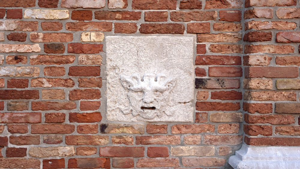
What is today known as ‘whistleblowing’ could once take the form of interacting with a threatening gaze carved into the city wall. It is the case of the ‘boche de Leon’ or ‘lion’s mouths’ disseminated by the old Venetian Republic throughout its territory to suppress illegal activities. Through a close… Read more »

As he navigates through the recurrent lockdowns of the pandemic, stranded between hitchiking and muggings, job hunting and separations, Fabio Valerio Tibollo rediscovers photography as a powerful coping mechanism. Recording everything that happened around him for one year straight, from attending momentous events to finding curiosity in shots of simple living,… Read more »

