Reframing Brownfields: on photography and environmental alteration in postindustrial Alps
Chimneys and conveyor belts, freight trains and warehouses are probably not the first things that come to mind when picturing the Alps. Yet this well-known European mountain range was, for decades, an area of feverish industrial activity. Today, with many of the old factories out of use, what can their massive remains teach us? Through the use of photography as a core element of his research methodology, Marcello Modica describes his experience of exploring these post-industrial sites.
Mountain areas are probably the last place where one would expect to come across postindustrial landscapes. Often associated with an idealised form of nature that no longer – if ever – exists, mountains are instead an extensive man-altered territory shaped by some of the most invasive and ‘raw’ global economies.
In the case of the European Alps, which are the most developed and therefore transformed mountain ranges worldwide, processes such as resource extraction, energy production and the implementation of mass tourism facilities, have all had a significant impact on the physical and social structure of the highlands.
After roughly one century of intensive industrialisation, from the 1980s onwards increasing costs of energy and raw materials, mainly due to liberalisation and globalisation processes, made the mountain decline as a reasonably viable production site. The remoteness of mountain locations and the growing environmental awareness also contributed, to the point that Alpine valleys are increasingly revealing the presence of some impressive productive infrastructures no longer in use.
Dense building ensembles, towering silos and chimneys, abandoned railway tracks and rewilding mining sites constitute, together, a significant spatial and environmental alteration firmly embedded in the wider, hosting mountain landscape.
This latter perspective, which eradicates the traditional aesthetic and cultural dichotomy between industry and mountains, has driven my own doctoral research project at the Technical University of Munich. The project aimed to investigate former industrial sites in the Alps, in order to develop a landscape-based approach that would accompany their physical and functional transformation.
The hypothesis is that, for this transformation to be effective for both the communities and the environment within such a complex socioecological system, what should be pursued is also a systemic design approach. In particular, we need to address the recycling of dysfunctional industrial elements according to their ‘reactiveness’ to both their spatial (land use patterns, scattered urbanisation, environmental sensitivity) and aspatial (economic mono-structures, administrative fragmentation, weak market forces) context.
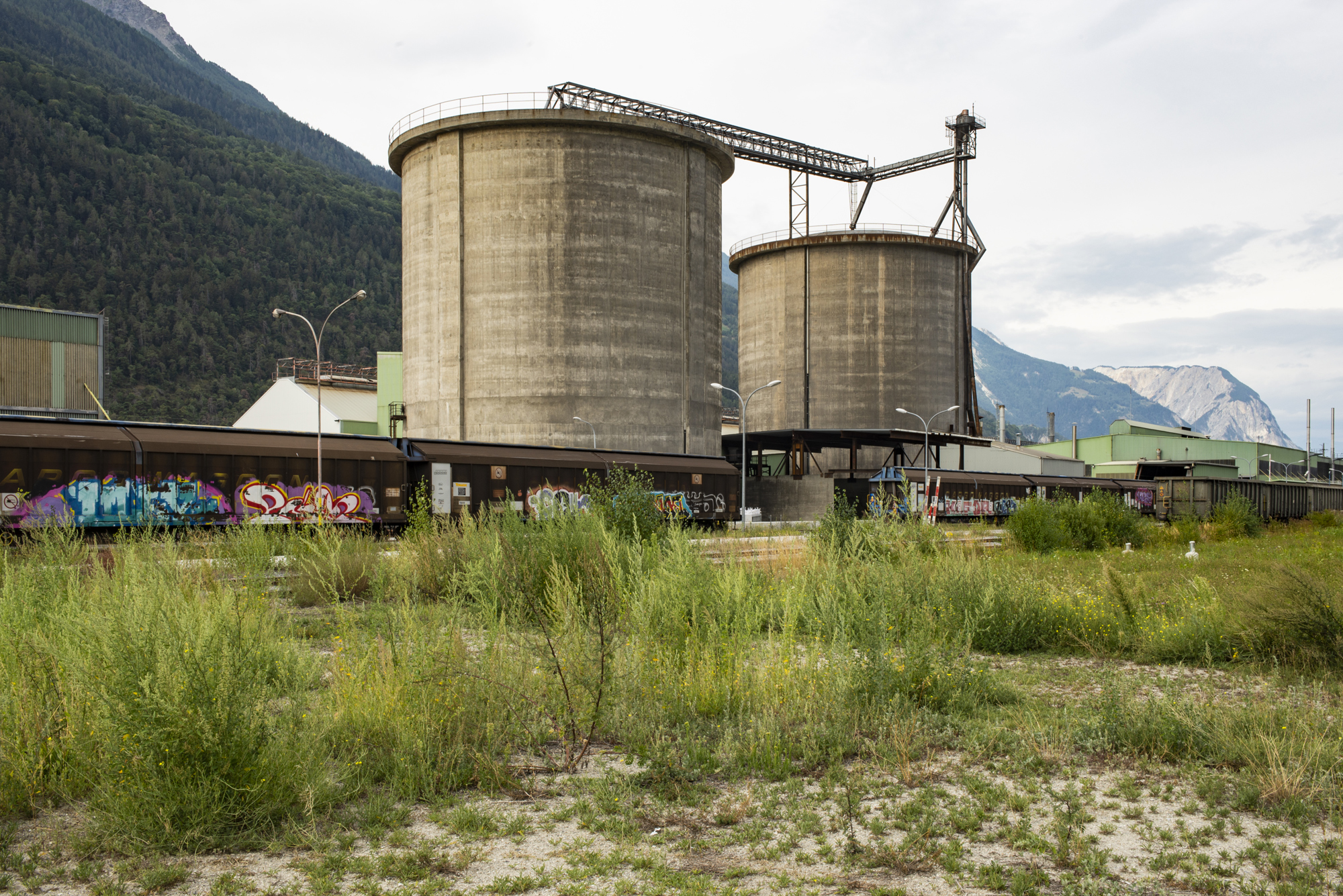
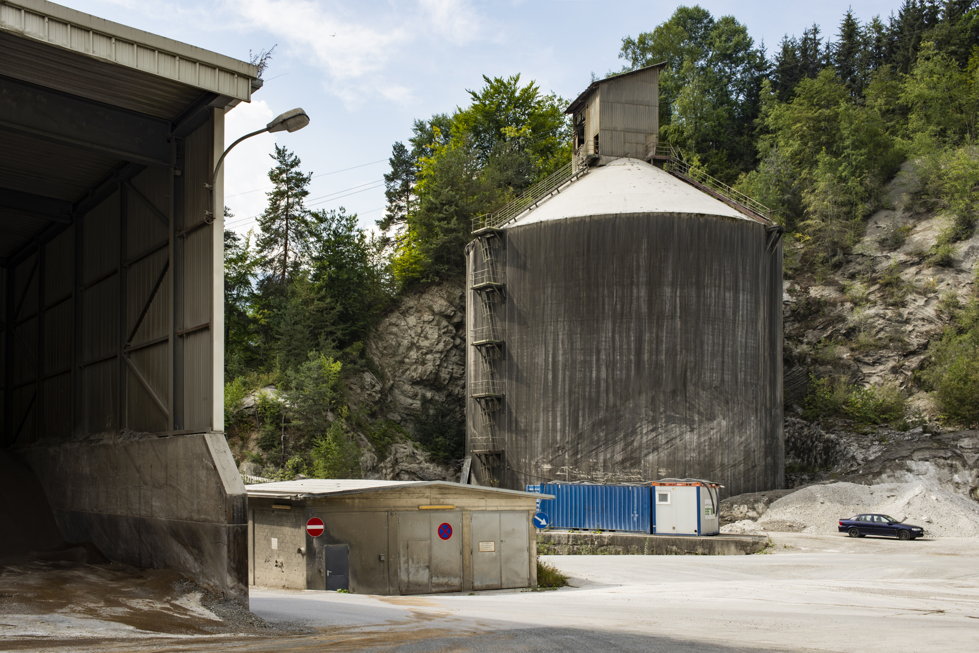
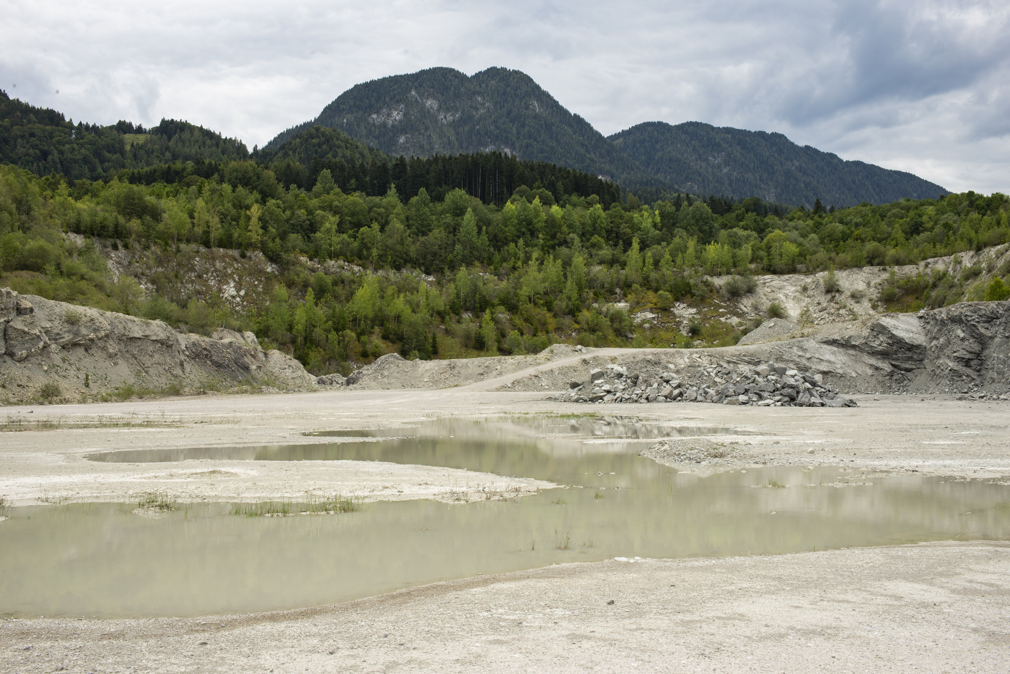
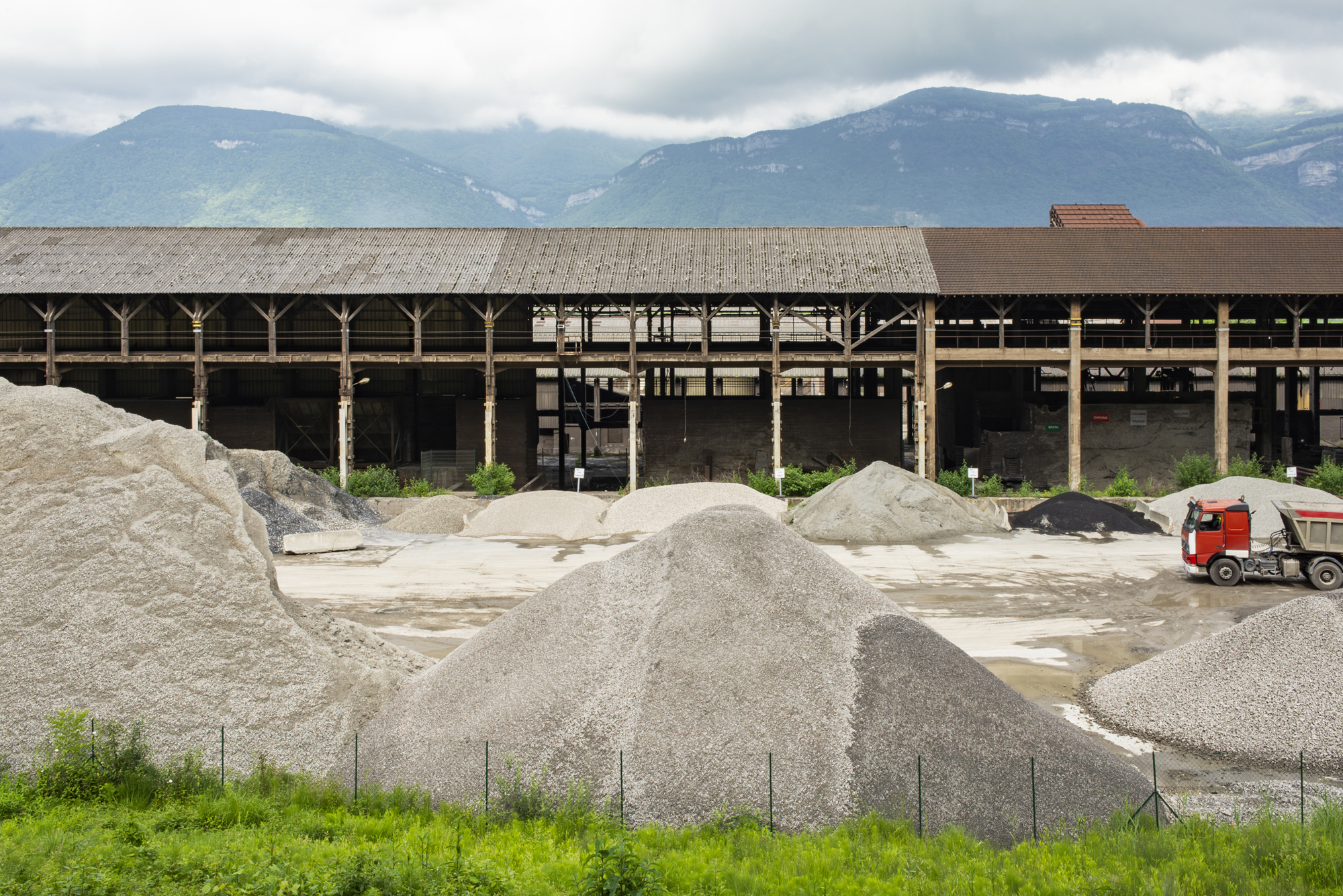
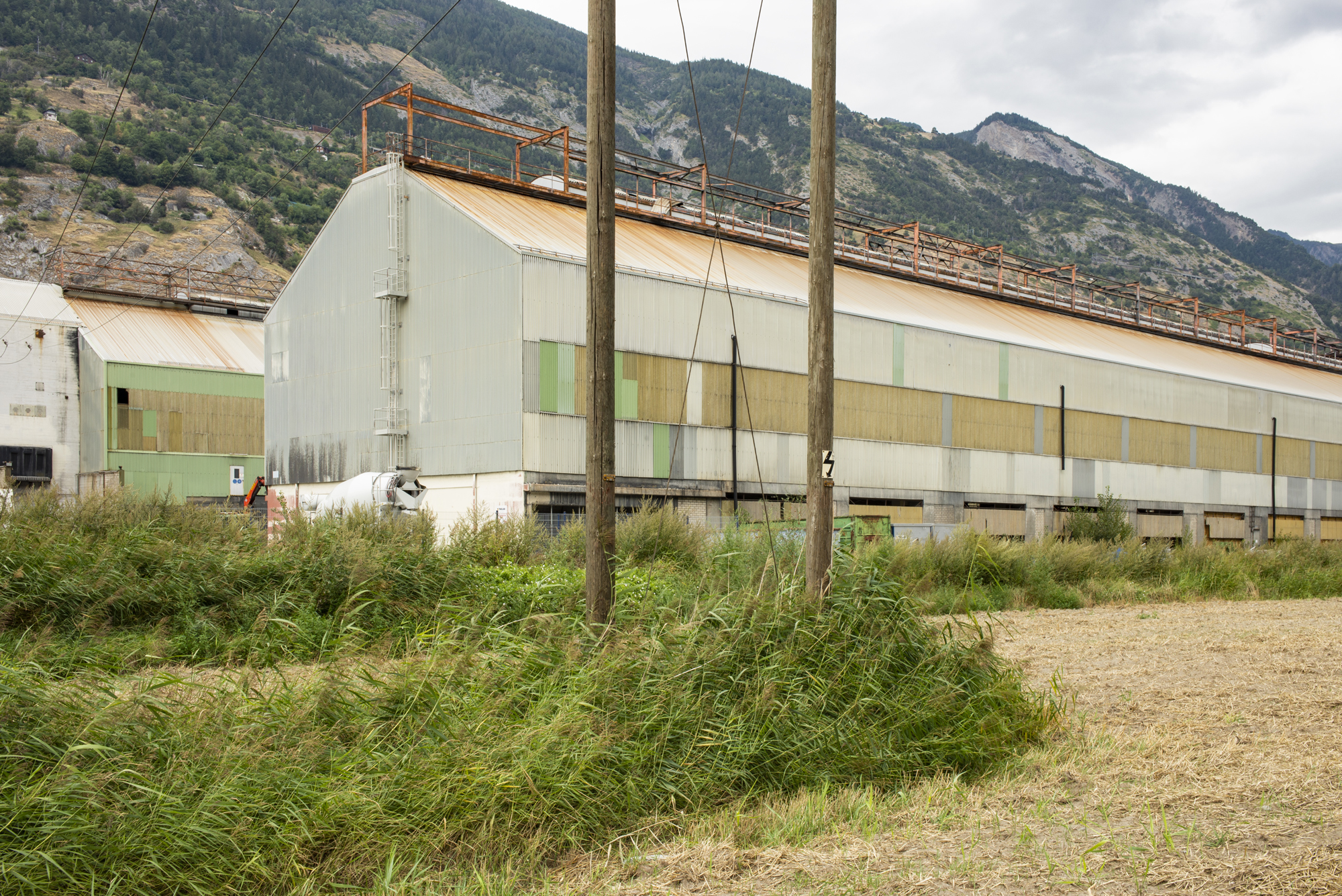
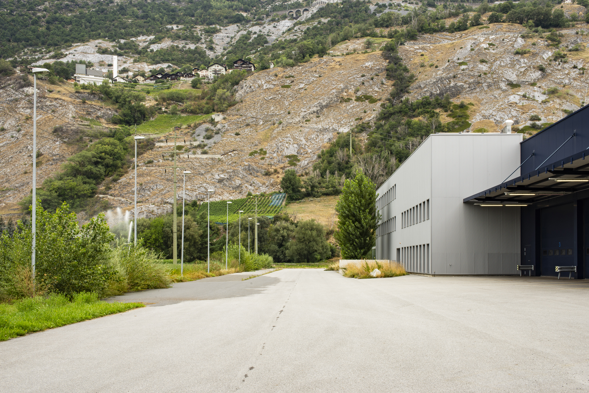
A crucial step in this direction is to ‘measure’ the spatial embedment of these physical elements by highlighting their strong infrastructural character for the territory and thus showing possibilities of transformation. To do so, an intensive photographic campaign was developed throughout summer 2018 across four cases study sites in Austria, France, Italy and Switzerland. The sites were previously selected among the roughly 150 mapped Alpine brownfields, as highly representative situations of the existing typologies of site-landscape interaction.1
This photographic campaign planned far in advance, was based on place-engagement and ‘environmental perception’ techniques. Partly derived from my own experience with post-industrial landscapes while also inspired by 1960s psychogeographic works by Kevin Lynch and Guy Debord. Photography was thus conceived as a sort of ‘informed’ recording.
However, part of the supporting information – the site’s socio-physical background as well as its previous history of transformation – was collected beforehand. This allowed us, to a certain extent, to reach an objective-as-possible overview of spatial forms and relationships that characterise industrial landscapes in a mountain setting.
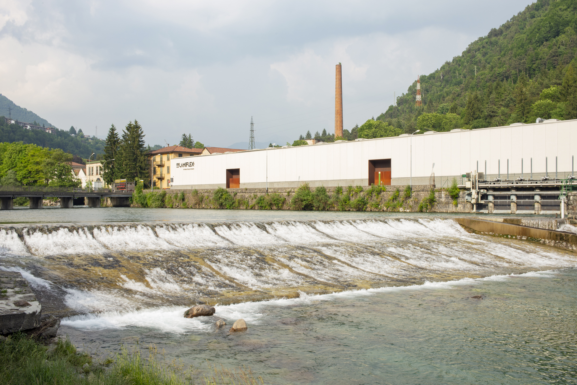
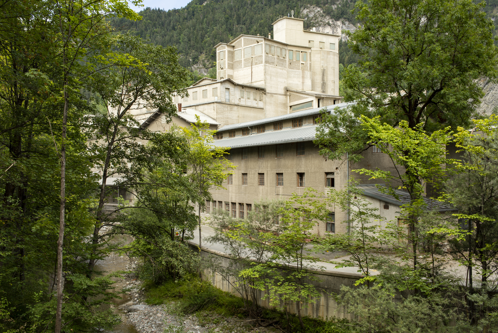
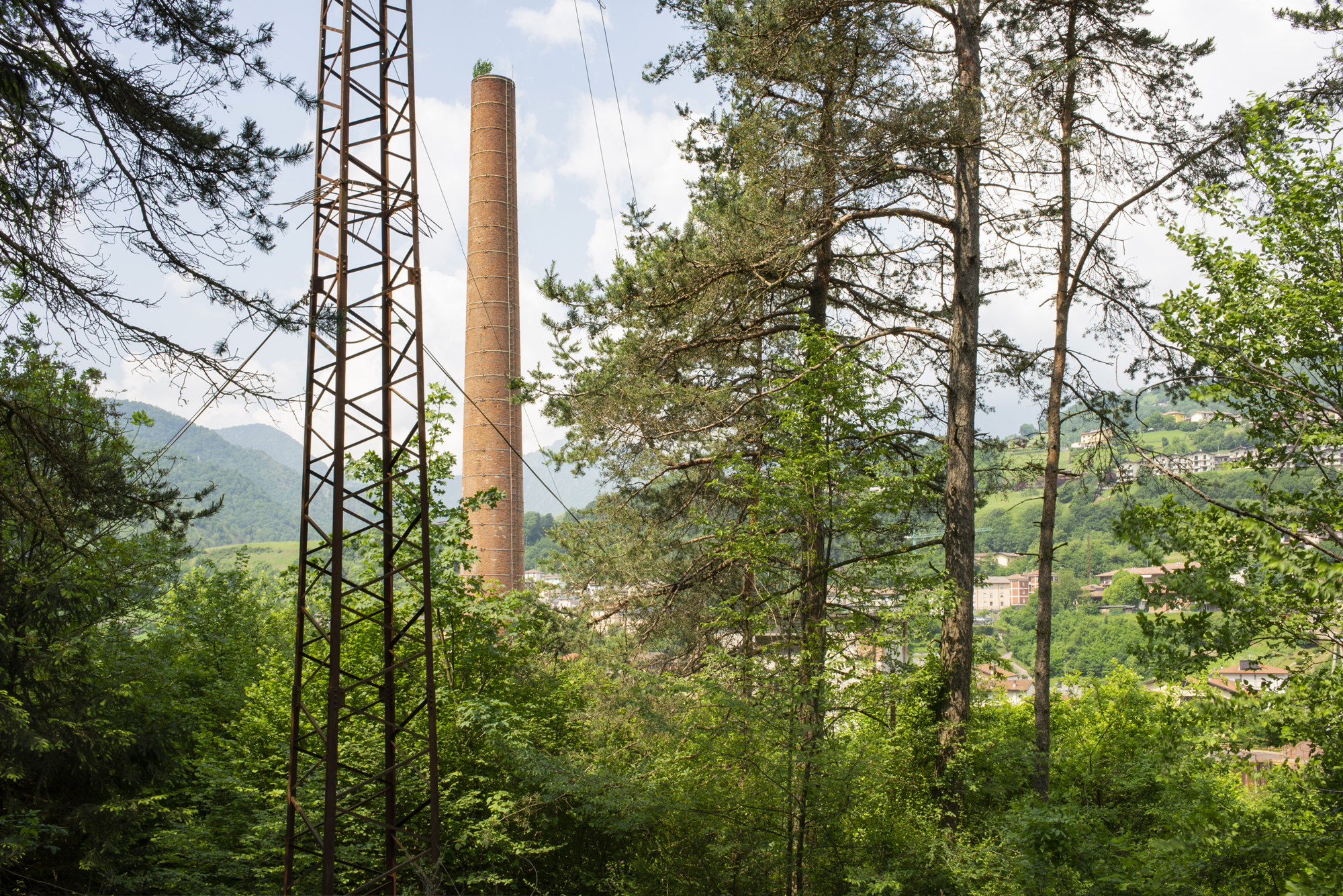
To provide a multi-scale overview of these contexts that span over hectares, the photographic mapping was developed around three main research foci. First is the ‘framescape’. This consists in a panoramic view of the site and its prominent structures. The framescape brings the visual and spatial interaction between industrial sites and the surrounding cultural landscape and natural morphology to the fore.
Second is the ‘hardscape’. This is the built-up core of the site – the former production engine with its own architectural quality and spatial density. It includes most of the former industrial buildings and structures within the site perimeter, as well as the in-between open spaces. And third is the ‘softscape’, that is, the complex network of unbuilt areas that, while being functionally connected to the production site, are also dissolved into its surroundings, like mining/quarrying or dump sites, or energy and transport infrastructures.
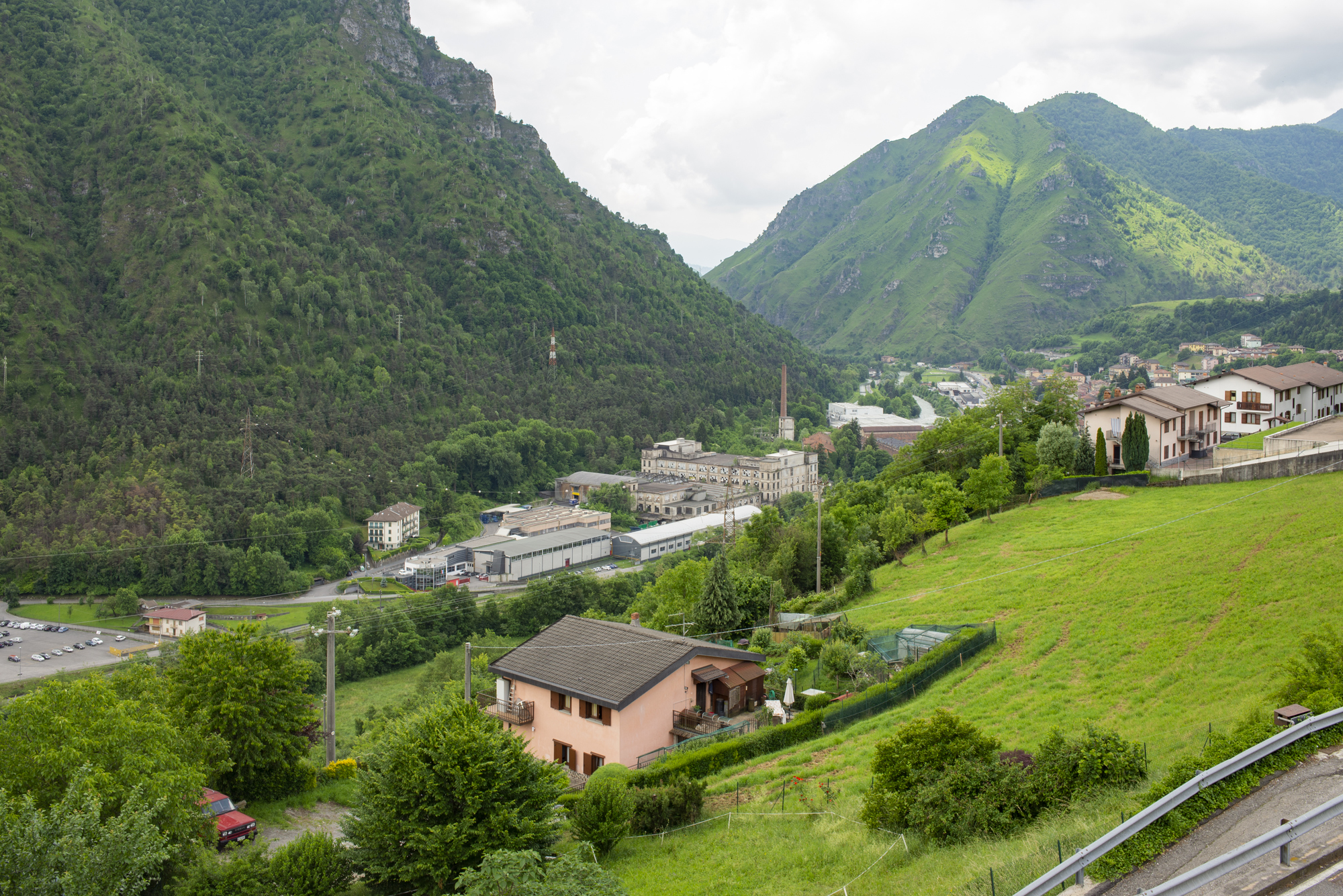
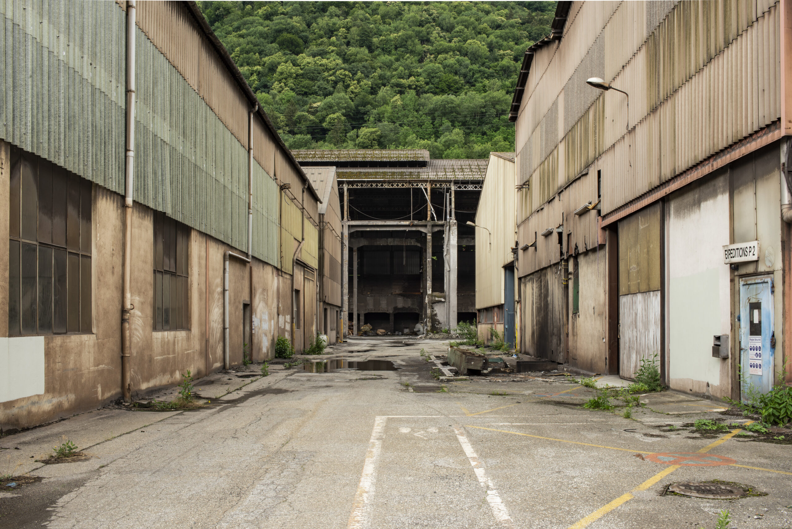
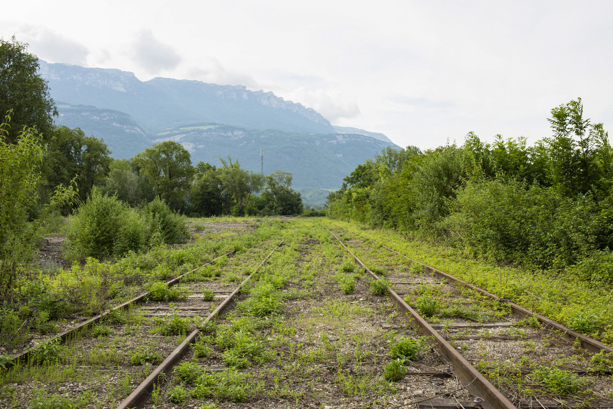
The result is a visual archive that allows, for each site, to be read through its environmental alteration and to understand to what extent this can be treated by further transformative interventions. The photographic campaign thus served, along with aerial photos, landscape maps and structural schemes, to identify the size, the range and the possible steps for future transformation – in other words, the quality of the site’s embedment within the landscape and its inherent workability.
Unlike traditional photographic surveys in architectural and urban practice, where photos are randomly used as a visual reference for a later design stage, here photography assumes a prominent and active role, as both a depiction of reality and a projection intent. This is not just the result of a slower, deeper approach to the place as a field of study, but of a research methodology that understands photography as an act of design in its own right.
This photographic approach to the rather unexplored territory of postindustrial landscapes in the Alps provided me with a powerful tool for the interpretation of the existing mountain space as a phenomenological space.
Almost imperceptible in many of the photographs, the mountain represents the condition by and within which industry once developed and then withdrew, generating, through this process, a unique combination of artificial ecologies and material juxtapositions.
Beyond their modification through deep time, exposed to the effects of wider economic development and the related intervention of human activity, mountains are continuously transforming. Contrary to common conception, the mountain is soft, and it breathes along with its transmutations.
Visually recording these changes allows us to frame an overview of its socio-physical receptivity, state of health and resilience. I believe this to be an urgent approach since it can help pave the way for a transformative territorial project that is inclusive, incremental and flexible, within and despite the apparent immutability of the hosting environment.
Footnotes & references
[1] Brownfields are previously developed sites (usually of industrial origin, as referred to here, but also military, commercial or agricultural), disused or underused, often including contaminated or ecologically-altered surfaces. See Modica, M. (2022) Alpine Industrial Landscapes. Towards a New Approach for Brownfield Redevelopment in Mountain Regions. Wiesbaden: Springer.
Recent articles
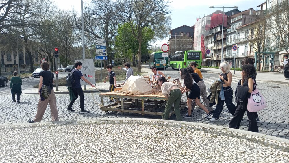
Unfolding through the city of Guimarães, Portugal, The Walking Body is an artistic research programme that explores collective walking as a methodology for situated knowledge, creative inquiry and engagement with place. Taking place across three consecutive editions (2024–2026), the programme has generated a range of artistic outputs: from drawings to… Read more »
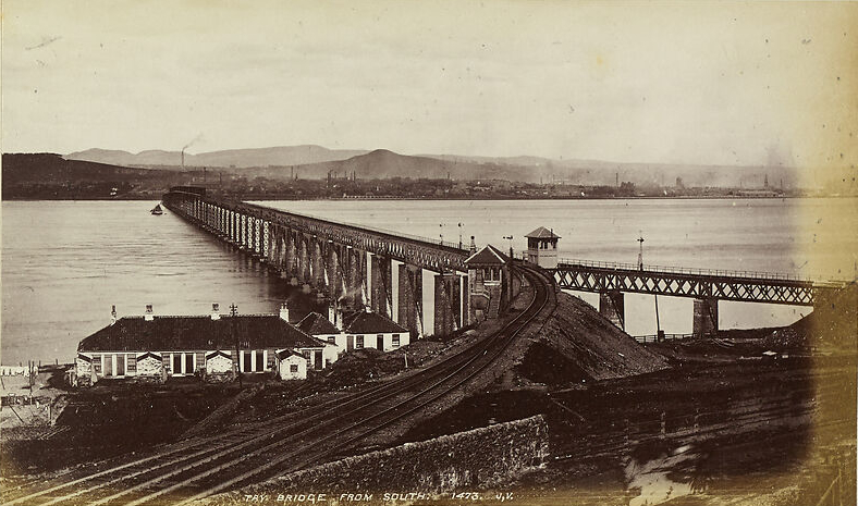
At some point in the early twentieth century, during one of her many travels to Scotland, Vernon Lee (the pen name of Violet Paget) visited the shores of Fife, then one of the country’s most heavily industrialised regions. Driven primarily by coal extraction and linoleum manufacturing, Fife’s industrial expansion left… Read more »
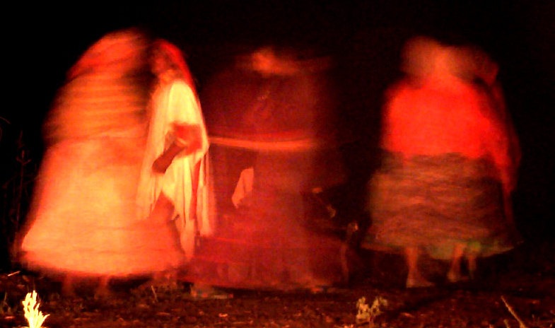
For our third contribution to the WALC project, movement on foot takes the form of long-distance running and ritual dance among the Ralámuli of Mexico’s Sierra Tarahumara, a practice that holds the power to heal and sustain the world. Author Sylvie Marchand has lived among them for years and reflects… Read more »